Historic Walks
In 1867, Bay View was established as the company town for the Milwaukee Iron Company. In 1879, Bay View incorporated as a village, but its village days ended in 1887 when it joined the city of Milwaukee.
In 1979, when the Bay View community celebrated its one hundredth anniversary, the Bay View Historical Society was founded as an outgrowth of the celebration. The idea came from Paul Kohlbeck, a teacher at Fernwood elementary school and Audrey Quinsey, who with her husband Bob, owned the Beulah Brinton house.
Part of the centennial celebration was a “Walk Through Historic Bay View” to provide a permanent, self-guided, tourist attraction. Bay View Historical Society President Ray Bethke, chairman of the walking tour committee, led the walk on August 25th. The Bay Viewer newspaper reported in its September 5, 1979 edition that over 200 persons had participated.
That inaugural walk was followed by an annual August Walk for the next 17 years. Through 1991, the walks were led by Ray Bethke, who was assisted by John Utzat. In 1992, Mel Graffenius led the walk through Humboldt Park. Bethke passed away February 13, 1995.
Beginning in 1993, the annual August walk became a walk/ride which was a bus tour to a historic site. One exception was in 1996 when the walk was titled “Walk Through Bay View” which featured the society’s twelve landmarks. Participants could either walk or ride a continuously-running shuttle bus.
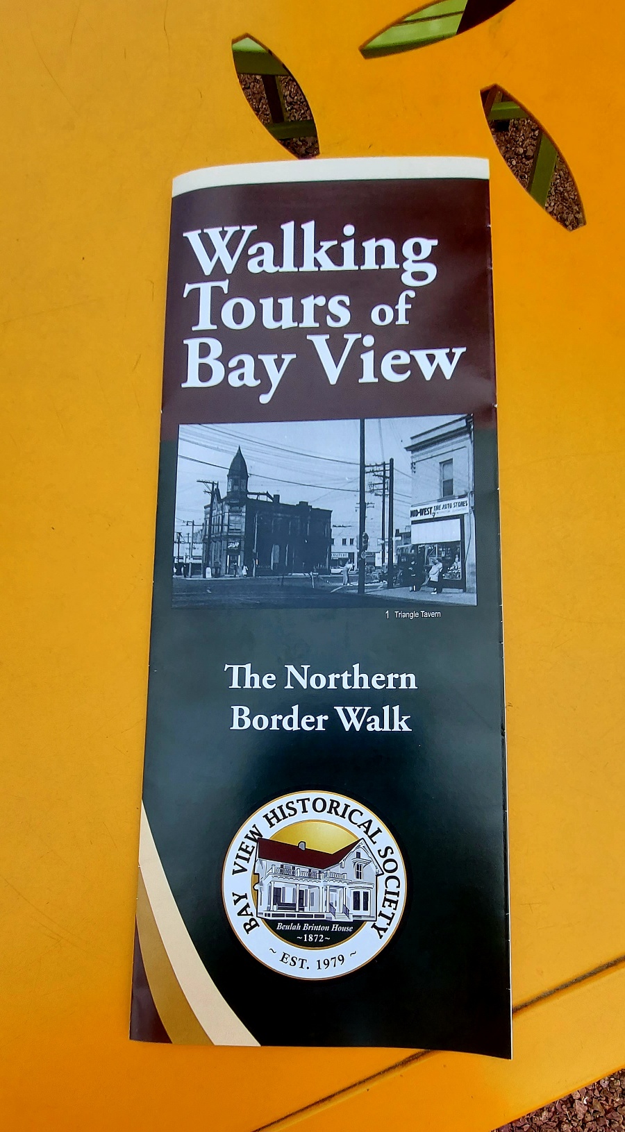
Then in 2003, the August Walk was revived with “The South Shore Walk.” It was modeled after “The South Shore Walk” taken from the 1987 brochure “Walking Tours of Bay View,” six walking tours within the boundaries of the original Village of Bay View, compiled by Ray Bethke and John Utzat. The brochure recognized the one-hundredth anniversary of when the Village of Bay View joined the City of Milwaukee. One side of the brochure listed the six walking tours and sites , but no information about the sites. The reverse side was a facsimile 1887 map of Bay View upon which those sites were located.
Starting with “The South Shore Walk,” Ron Winkler located and researched the sites for the six walks. The Bay View Historical Society created a high-quality brochure for “The South Shore Walk,” which was held in August 2003.
Each year Winkler researched a different walk and the society created a new brochure, which was introduced at the August Walk. He expanded the number of walks to nine by adding three additional walks outside of the original Village of Bay View in order to cover the area of what is considered Bay View today.
When it came time for brochure number six in 2008, the society was in the midst of a money crunch due to its purchase of the Brinton House in 2005. Production of the brochure was put on hold, but the research and the walks were still held. Now the society is at a point where it can afford to produce the brochures and the last four will be printed soon.
With revival of the August Walk in 2003, we’ve had two separate walks each year. Ron Winkler is the guide for history majors, while the second walk has been led by Todd Smith, John Sternkopf, and currently Greg Wernisch.
South Shore Walk
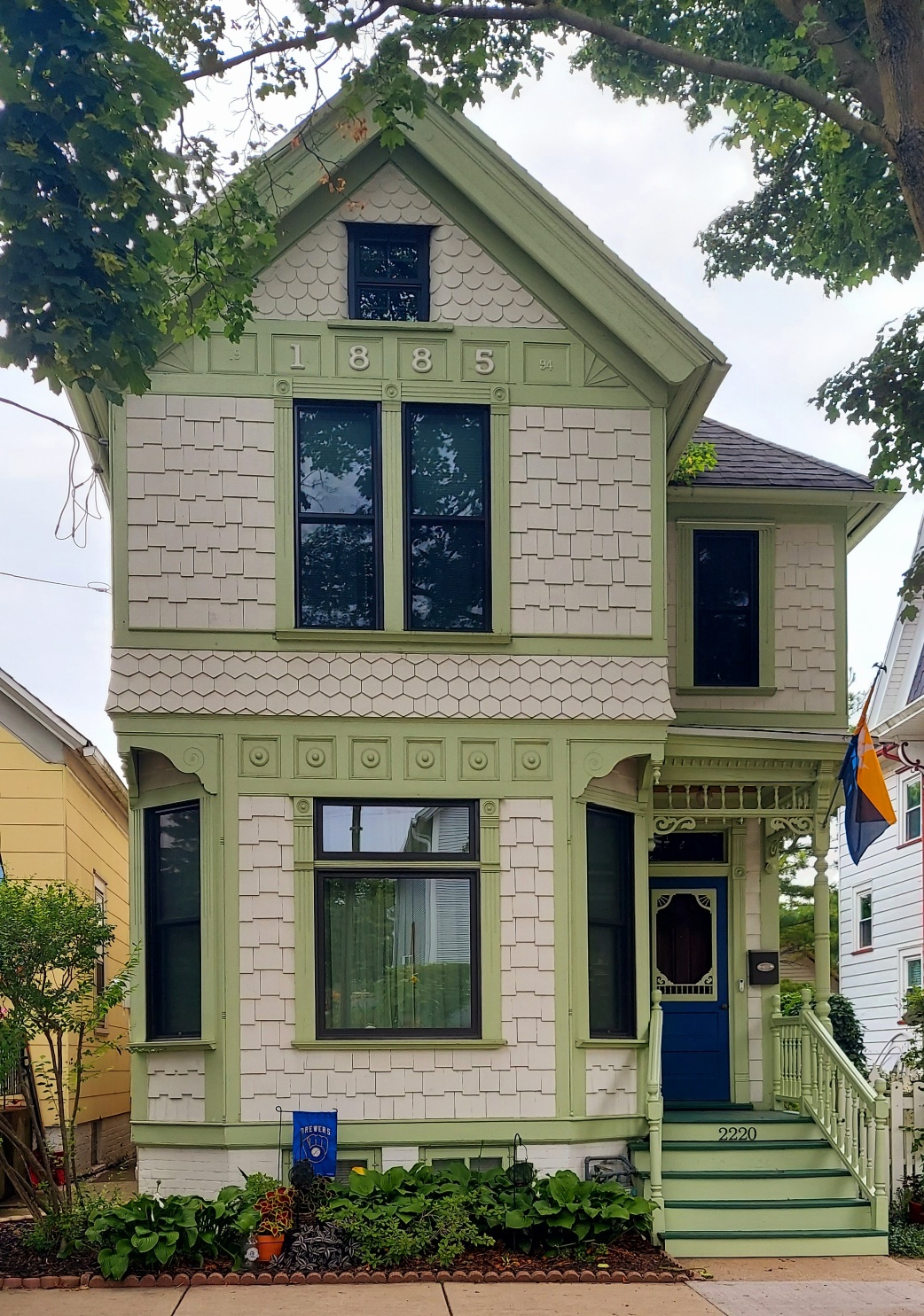
The South Shore Walk’s borders are Ontario Street on the north, Oklahoma Avenue on the south, Lake Parkway on the west, and Lake Michigan on the east. Most of this area was originally the farm of pioneer Elijah Estes, a portion of which was developed into South Shore Park beginning in 1909. In 1867, the area north of today’s Nock Street became the original Bay View, Eber Brock Ward’s company town for the Milwaukee Iron Company. It features the Pryor Avenue Well and the homes of Beulah Brinton, George Edmunds and the Estes family.
Within the South Shore Walk is the Bay View Historic District, named to the National Register of Historic places in 1982. The historic district’s boundaries are Lake Michigan on the east, St. Clair Street and Delaware Avenue on the west, Conway Street on the north, and the south end of South Shore Park at Meredith Avenue on the south.
The Iron Company Walk
The Iron Company Walk features Jones Island and the site of the old Milwaukee Iron Company (also known as the North Chicago Rolling Mill and United States Steel). It includes stores, boarding houses and homes that were part of the company town platted on January 12, 1867 by Eber Brock Ward as Bay View.
This tour could also be called “The Little Italy Walk” because many Italians settled in the area bounded by Russell Avenue, today’s Lake Parkway and the rolling mill during the first two decades of the 20th century. These Italians replaced the original English, Welsh, Scottish and Irish who had moved to newer areas of Bay View. As the Italian population grew from 43 in 1905 to about 1,000 in 1920, this area became known as “Little Italy.” This tour highlights some of the Italian-owned businesses such as Groppi’s Grocery and DeMarinis’ Restaurant.
The borders of the Iron Company Walk are Conway Street on the north, Nock Street on the south, Logan Avenue on the west, and Lake Michigan on the east.
The KK-Link
Kinnickinnic Avenue, also known as KK, was an old Indian trail which takes its name from the river which it crosses north of Becher Street. Kinnickinnic means “it is mixed” and comes from a blend of tobacco, leaves and bark which was smoked by Native American Indians who inhabited this area prior to the 1830s.
The KK Link contains one of Bay View’s two main commercial districts. The first district extends south on KK from the Five Points intersection of Lincoln, Howell and KK to the Bay View Library. This area of Bay View, west of the Lake Parkway, was settled by Germans and was once a fashionable residential district. Many of its homes and churches reflect their German heritage, and were designed or built more than a century ago by well-known architects and contractors.
The KK-Link’s boundaries are Lincoln Avenue on the north, Dover Street on the south, Howell Avenue on the west, and Lenox Street on the east.
The Midtown Walk
Kinnickinnic Avenue, also known as KK, was originally an Indian trail widened by pioneers and then the military in 1832. Its meandering tendency has created several triangles at intersections that give this area a small-town feel.
The Midtown Walk includes Downtown Bay View, the southern portion of the Kinnickinnic Avenue business district between Potter and Logan Avenues. The borders of the Midtown Walk are Conway Street on the north, Montana Street on the south, Williams Street on the west, and California Street on the east.
This area of Bay View developed when neighborhoods were designed for pedestrians, with businesses scattered throughout residential areas. It has a village aspect enhanced by churches and retailers, a former convalescent home, converted storefronts and well-preserved houses, Bay View High School, and the old Llewellyn library.
Way Down South Walk
The Way Down South Walk covers the southwest corner of the original Village of Bay View. This was the last area of Bay View to be developed and it contains the newest homes – some built as late as the mid 1950s – and a variety of architectural styles.
This largely residential area has a few businesses scattered throughout and emphasizes recreation and leisure. It features three park sites: the former Union Park was a private park and popular picnic spot typical of the beer gardens frequented by Milwaukeeans before free public parks existed; Humboldt Park is one of the five original public parks that the City of Milwaukee established in 1890; and Sijan Field, owned by Milwaukee Public Schools, is a playground converted from a former brickyard and dump.
The borders of the Way Down South Walk are Russell Avenue on the north, Oklahoma Avenue on the south, Howell Avenue on the west, and Lake Parkway on the east.
Western Border Walk
Dr. Enoch Chase, original owner of the area encompassed by the Western Border Walk, owned a farm, brickyard and bottle making company. When Chase subdivided his land, he laid out and named the streets, and built homes. Most of Chase’s farm west of the Kinnickinnic River became Baran Park, with Chase Avenue as its western border.
East of the river, other businesses moved in and this area became the cradle for many world-renowned companies such as Milwaukee Valve, Filer & Stowell, Vilter Manufacturing and Jerome B. Meyer and Sons, the only company still in Bay View. The Keller Winery operated until 1943; its well-preserved buildings (including the cellar dug into the hillside) and some original grapevines are highlights of the walk.
St. Augustine Catholic Church on Howell Avenue has been a pillar of Bay View since 1887. Other buildings and homes featured on the tour range in age from before the church into the 1920s.
The borders of the Western Border Walk are Lincoln Avenue on the north, Deer Place on the south, First Street on the west, and Howell Avenue on the east.
Fernwood & Sauerkraut Hill
Bay View and the Fernwood/Sauerkraut Hill area were originally part of the Town of Lake, created in 1838. The Village of Bay View was formed in 1879 and when it joined the city of Milwaukee in 1887, the city’s southern border extended to Oklahoma Avenue.
Across Oklahoma Avenue in the Town of Lake, James Douglas owned a real estate development whose boundaries extended from Oklahoma Avenue to Morgan Avenue and from Kinnickinnic Avenue east to the St. Francis Seminary. He named this heavily wooded area Fernwood. West of Kinnickinnic Avenue, Sauerkraut Hill takes its name from its large German population.
Fernwood became part of Milwaukee in 1924 through the efforts of Bay View’s Socialist Alderman Paul Gauer. Its residents, paying high taxes to the Town of Lake and getting nothing in return, formed the Fernwood Annexation Club. They wanted the same amenities enjoyed by Bay Viewites such as sidewalks, sewers, garbage collection, streetlights, and a fireproof school.
Sauerkraut Hill became part of Milwaukee in 1927.
The borders of the Fernwood & Sauerkraut Hill Walk are Oklahoma Avenue on the north, Morgan Avenue on the south, Lake Parkway on the west, and Lake Michigan on the east.
Southwestern Border
Bay View and the area covered by the Southwestern Border were originally part of the Town of Lake, created in 1838. The Village of Bay View joined the city of Milwaukee in 1887 and over the years the remaining Town of Lake land was added to the city of Milwaukee.
The area of the Southwestern Border is bounded by Oklahoma Avenue on the north, Morgan Avenue on the south, Clement Avenue on the east and 6th Street on the west. The tour also includes the area north of Oklahoma Avenue to Russell Avenue between Humboldt Park and 6th Street.
Bitter battles were fought between The town of Lake and Bay View’s alderman Paul Gauer to annex this area. Town residents wanted to join Milwaukee to obtain the amenities enjoyed by their Bay View neighbors such as paved streets, schools, sewers and water. When these areas were annexed piecemeal between 1922 and 1929 they joined not Milwaukee, but also Bay View.
The Southwestern Border has some old farmhouses dating to the late 19th century, but most homes were built after 1925. There are a number of churches (Unity Lutheran, Chapel of the Cross Lutheran, United Church of Christ, St. Luke’s Episcopal), schools (Humboldt Park and Parkside) and businesses (Caterpillar, Prasser/Kleczka Funeral Home, Nash/American Motors/Chrysler) on this tour.
Northern Border Walk
The Northern Border Walk covers the area north of Lincoln Avenue. Its boundaries are Lincoln Avenue on the south, Stewart Street on the north, First Street on the west, and Lenox Street on the east.
This area has been part of the city of Milwaukee since 1857, yet for some reason, it attached itself to Bay View sometime after 1887 when Bay View joined the city of Milwaukee.
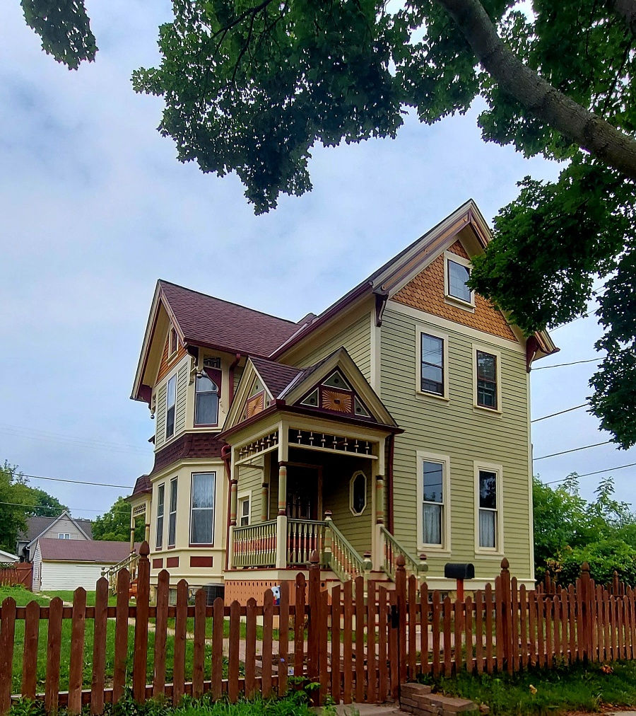
The walk begins in the residential area north of Lincoln Avenue and east of Kinnickinnic Avenue. The second section is centered on the industrial area north of Bay Street. The final section travels along Kinnickinnic Avenue’s historic buildings. Most of the Northern Border Walk is unfamiliar to even residents of Bay View.
2023 Historical Walk: Bay View’s Northern Border Walk
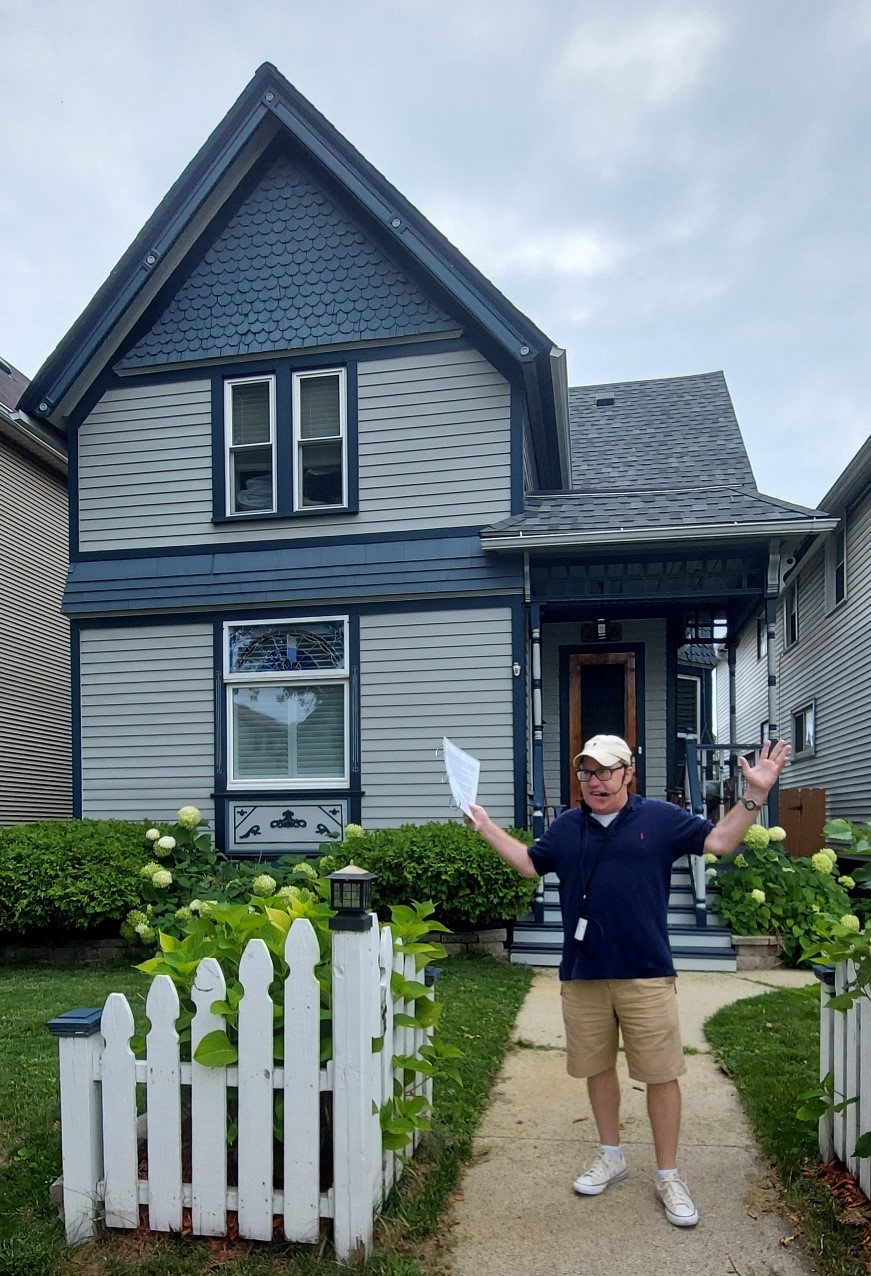
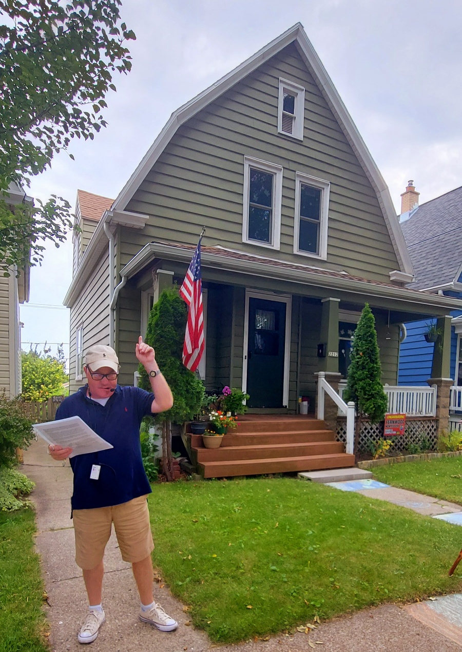
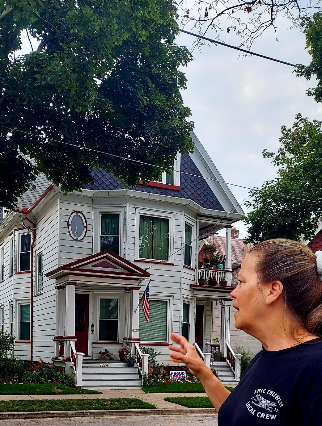
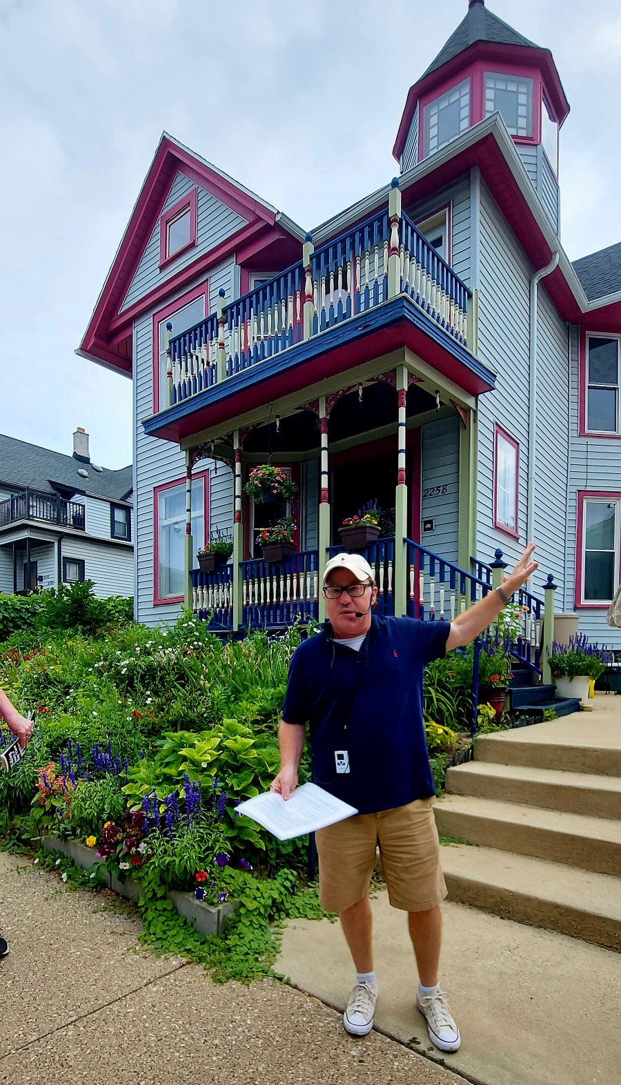
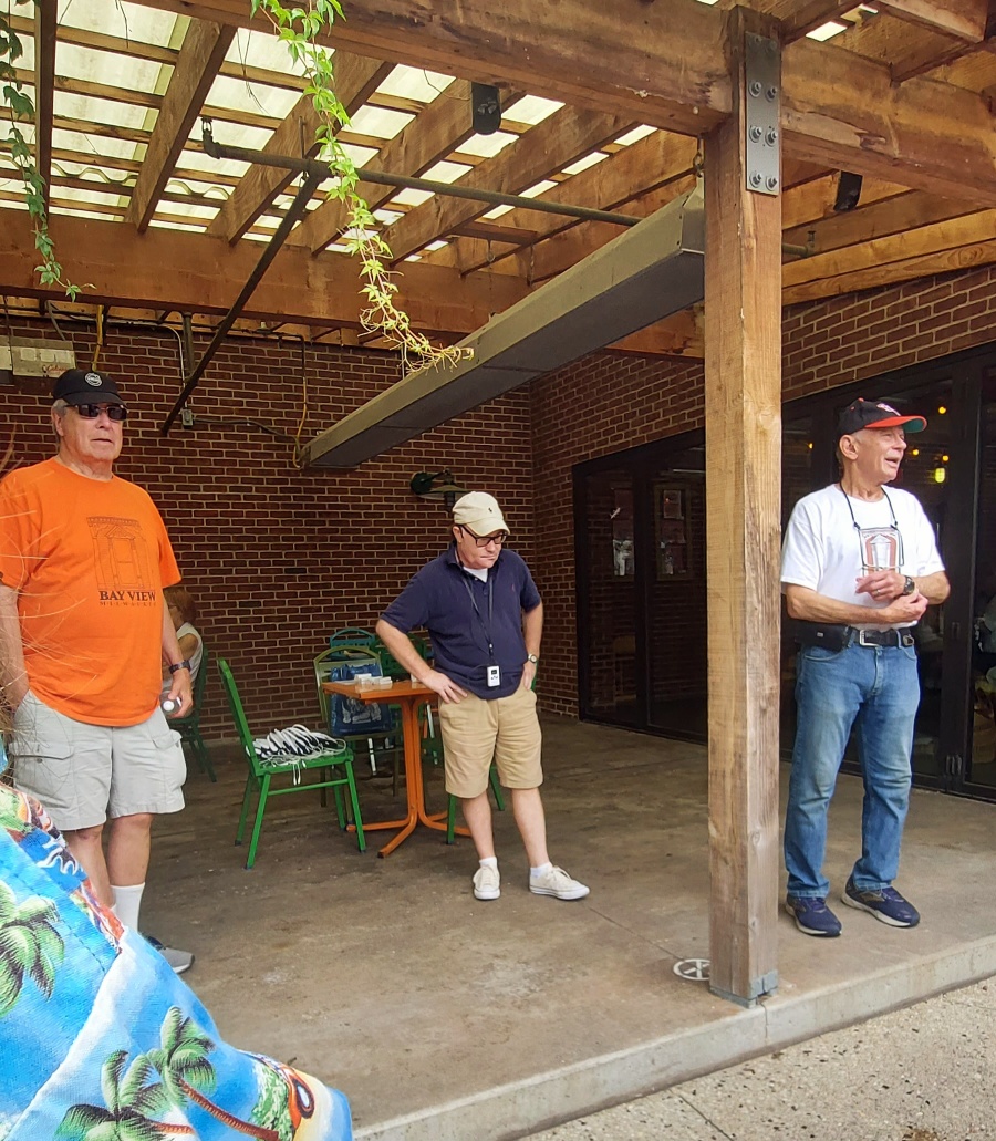
This year’s annual Bay View Historical Society (BVHS) August Walk took us to the Northern Border. The walk, held on Saturday, August 5th, started and ended at Colectivo Coffee, 2301 S. Kinnickinnic Avenue. Cost was $5.00 for members and $10.00 for nonmembers. Thanks to Society President Margaret Herzfeld along with her mom Sue Herzfeld for registering the walkers. The temperature this year was a pleasant 75 degrees in contrast with last year’s 89 degrees with a heat index of 95 degrees.
Each participant received a copy of the newly-printed Northern Border Walk brochure, part of the series of nine walking tours designed to help Bay Viewites and visitors gain an appreciation for Bay View’s history, architecture and lifestyle. The brochure was researched by Ron Winkler and designed by Kevin Petajan, Society members.
Ron Winkler and new tour guide Sean Regan shared their knowledge of Bay View with the walkers. Sean received many compliments from his followers. He has a vast knowledge of Bay View gained from attending previous BVHS August walks, along with leading his own walking tours of Bay View that he designed for Historic Milwaukee, Incorporated. His curiosity about Bay View continues to add new perspectives to his tours.
The Northern Border area has been part of Milwaukee since 1857, yet it attached itself to Bay View sometime after 1887 when Bay View became Milwaukee’s Seventeenth Ward. With the exception of Kinnickinnic Avenue, Lincoln Avenue and Bay Street, most of this region is unfamiliar to even Bay View residents.
Next year the BVHS will print the Southwestern Border Walk brochure, which will complete my series of nine walking tours of Bay View. It will be introduced as our 21st Annual August Walk, tentatively scheduled for Saturday, August 3, 2024.
Tickets to the annual August historic walk are available in the shop.